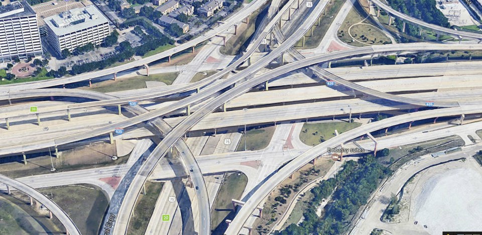
It is hard to imagine the United States without its interstate highways, the 43,000-mile (68,600-kilometre) limited access multi-lane divided expressways that carry people and commerce from coast to coast and border to border without a single stoplight. It’s been called the world’s greatest civil engineering project, larger than the Great Wall of China, the Egyptian Pyramids or the Panama Canal.
It fulfilled a dream President Eisenhower had since 1919 when the 28-year-old lieutenant participated in a post-First World War motorized military convoy to highlight the terrible condition of United States roads. They followed the Lincoln Highway from New York to San Francisco, the approximate route of today’s Interstate 80.
The toll of collapsed bridges, mired vehicles and personal injuries convinced Eisenhower the nation sorely needed a good highway system. This was further reinforced during the Second World War when, as supreme commander of the Allied Forces, Eisenhower was impressed with how efficiently Germany’s autobahns moved troops and equipment, including those of the Allies, around the country.
Authority for the interstate system was the federal-aid highway act of 1956, signed by the President on June 16, 1956. Officially called the Dwight D. Eisenhower System of Interstate and Defence Highways, it became known simply as the interstate highway system, or just the interstate.
The interstate system was a federally sponsored program that the states could join voluntarily. Since the U.S. Government reimbursed 90 per cent of the cost, all states participated. Existing toll roads like the Pennsylvania Turnpike were incorporated and approximately five per cent of the system is tolled.
Engineers and construction crews began work quickly after signing and before the end of 1956 the first sections of interstate were completed. Standardized materials and specifications were enforced throughout, stipulating a limited access highway with a minimum of two 12 foot (3,658 mm) wide lanes in each direction.
Although engineered for 70 mph (112 km/h) it could accommodate higher speeds. Indeed, some states like Nevada and Montana had no limits, asking motorists only to drive in a “reasonable and proper” manner. Curves were gentle and banked and the roadway was smooth and as straight as terrain allowed. Realizing the potentially hypnotic affect of straight ahead driving, rest stops were usually planned about 35 mi (56 km) apart.
Drivers were guided on their way by distinctive red, white and blue number shields. Information was conveyed on rectangular green and white signs. East–west highways were even numbered and north-south, odd. Numbering started in the south-west corner of the country, e.g., I-5 runs north from San Diego, California to the Canadian border and I-10 runs east from Los Angeles to Jacksonville, Florida. By-passes and spur routes have triple numbers, e.g., route 285 around Atlanta.
Interstates gradually displaced such iconic roads as the Lincoln Highway and Route 66 from Chicago to Los Angeles which had a special place in American folklore. During the 1930s Route 66 carried countless souls fleeing the dust bowls of states like Oklahoma and Kansas seeking better lives in California. John Steinbeck’s “The Grapes of Wrath,” a poignant novel about Depression ravaged west-bound families, made Route 66 famous as the “Mother Road.”
Although immortalized in television and song, Route 66 was gradually replaced by interstates, the last piece between Chicago and Joplin, Missouri being decommissioned in 1985. The Mother Road is officially gone but its memory and lore live on in Route 66 Associations and the remaining remnants of broken, weed infested pavement.
A system that traverses a half continent of rivers, canyons, mountains and railroads requires lots of bridges, some 55,000 on the interstate. Some float, like the Lake Washington floating Bridges in Washington State. There is a combination bridge and underwater tunnel, the Monitor and Merrimac suspension bridge in Virginia. Some are beautiful like the cable-stayed Sunshine Skyway in Florida and the Mackinac suspension bridge in Michigan. Most, however, are the nondescript girder bridges that form the backbone of the system.
Tunnels also play an important role. Although more expensive than bridges, there are more than 100 on the interstate system, one of the most impressive being the I-95 eight-lane, 1.7 mi. (2.7 km) Fort McHenry tunnel under the harbour in Baltimore, Maryland. Mountain tunnels include Eisenhower Memorial Tunnel under Loveland Pass in Colorado’s Rocky Mountains, the world’s highest tunnel and the interstate’s highest point at 3,400 m (11,155 ft) above sea level.
Although scheduled to be finished in 1972, changes, route controversies and additions delayed final completion until early in the 21st century. It came with the completion of Boston’s Central Artery/Tunnel Project nicknamed the “Big Dig,” 42 mi (68 km) of highway lanes carrying I-90 and I-93 beneath Boston. It is the most elaborate tunnel system ever built, a fitting tribute to President Eisenhower’s dream.


