
There are 11 names on or near Vancouver Island that appear on a in sa���ʴ�ý.
Tatsno Lakes: Freda Berkley and Miss Hester
The name Tatsno is of Kawitshin origin, and means “my younger sister.” It refers to two local alpine club members involved in exploring the area.
According to provincial records, the name Tatsno Lakes was adopted in 1939, and confirmed in 1948.
Freda Lake was first suggested at a public meeting in 1935 at Courtenay to determine potential names for previously unnamed features on a new map of Forbidden Plateau. The name refers to Freda Berkley, a member of the party who first explored a route to the Comox Glacier and a staff member at the biological station at Nanaimo. She was considered the first white woman to go into the glacier region.
At the same time, the name “Hester Lakes” was suggested by Mr. Harold Cliffe. A committee determined it “advisable [to give] distinctive [First Nations] names to this feature and suggest Tatsno, meaning my younger sister, associating the names and memories of Miss Freda Berkley and the Miss Hester mentioned in Cliffe’s recommendations.”
Trevor Channel: Frances Hornby Barkley
Frances Hornby Barkley (née Trevor) was married to Capt. Charles William Barkley of the Imperial Eagle and travelled extensively with her husband. Her diaries were compiled into The Remarkable World of Frances Barkley, 1769-1845, an account of her adventures at sea.
She was with her husband when he “discovered” Barkley Sound in 1787. According to H.D. Parizeau of the Hydrographic Service, Frances, the daughter of a Protestant minister, was 17 at the time.
The name Trevor Channel was adopted in 1945, replacing Eastern Channel on British Admiralty maps.
Her unpublished reminiscences, written in the latter days of her life, and now in the provincial archives in Victoria, are the main source of information about this and later voyages.
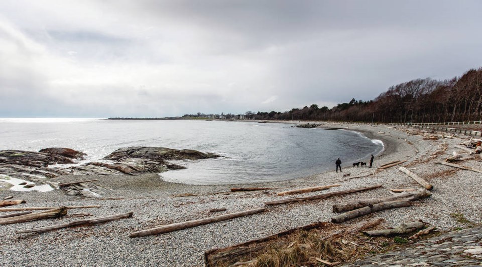
Ross Bay: Isabella Ross
The wide bay is named for Isabella Ross (née Mainville), a pioneering Métis woman of Victoria. She was married to Hudson’s Bay Company trader Charles Ross, a founder of Fort Victoria. Following the death of her husband in 1844, Isabella moved her family to Washington territory for several years. She returned to Victoria in the early 1850s, and by signing the deed to the 99-acre property above the bay, became the first registered female landowner in British Columbia.
She named her property Fowl Bay Farm because of the abundant waterfowl. It was not successful, and Isabella sold portions of her property to individual buyers. The city purchased the remote slope overlooking Ross Bay for use as a cemetery, which was opened in 1872. Isabella died in 1885, at age 77, and was buried in an unmarked grave at Ross Bay Cemetery. In 1994, an interpretive plaque was installed at her grave site.
Naylor Bay: Emma Naylor
The bay on Mayne Island is named after Emma Naylor (née Collinson). Her father was the first storekeeper and postmaster on Mayne Island in the late 1800s.
The sa���ʴ�ý Geographical Names office said origin notes for Naylor Bay have not yet been transferred from paper records and maps to its website, but updates can be expected.
Crowther Canyon: Ann Unsworth Crowther
This deep-sea canyon was named after Ann Unsworth Bailey (née Crowther), who travelled to Victoria from England with her parents in 1862. In 1876, she moved with her husband to Kyuquot on northwestern Vancouver Island, where he was the operator of a trading station. They remained for six years, during which time she was the only European woman in the area.
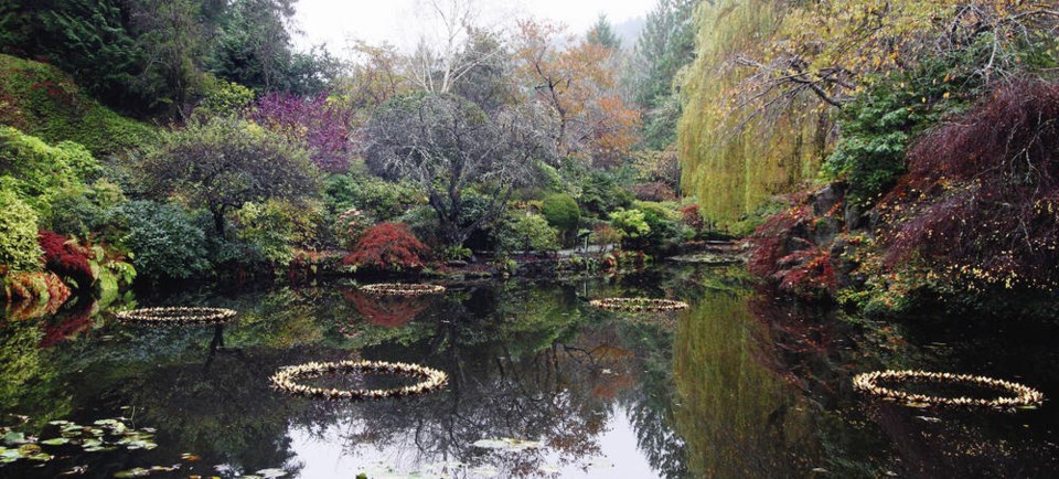
Butchart Gardens: Jeannette Foster Kennedy Butchart
Jennie Butchart began to shape Butchart Gardens in 1904. She established, in the style of the grand estates of the period, several distinct gardens to evoke a range of esthetic experiences. An abandoned limestone quarry was transformed into the dramatic Sunken Garden, a reflection of the early 20th-century beautification movement and an exceptional achievement in Canadian gardening history.
Butchart Gardens was designated a National Historic Site of sa���ʴ�ý in 2004. The designated area of the gardens occupies 5.26 hectares and includes the residence that was remodelled and enlarged for the Butcharts by architect Samuel Maclure.
McBey Islets: Nellie Georgina McBey
The group of five small islets south of Meares Island are named for Nellie Georgina McBey (née Stewart). She was involved in naming several species of plant life on Vancouver Island, according to the province’s heritage branch.
The rocky formations were originally named Dinner Islets, as labelled on British Admiralty Charts, but the name was changed to McBey Islets in 1934 and confirmed in 1947 after a recommendation by the Hydrographic Service.
Nellie was born in 1883 at Urrafirth, near Lerwick on the Shetland Islands. Her father was a school headmaster and botanist. She discovered and documented several species of plant life on Vancouver Island, including Ericameria ericoides, also known as California heathgoldenrod or mock heather.
Helen Lake: Helen Ford
The lake is named after Helen Manning Hunt Ford, a longtime resident of the area who moved to the Alberni Valley in the late 1930s. During the Second World War, she served with the Canadian Women’s Army Corps, where she attained the rank of major. She became a Member of the British Empire in 1946. She devoted countless hours to community groups, including the Alberni District Museum and Historical Society, and was presented with the Alberni’s Citizen of the Year award in 1983. Helen and her husband donated 52 hectares of land to the province to become Fossli Provincial Park. The official name was adopted on Dec. 1, 1998.
Emily Lake: Emily Lawson
The lake is named after Emily Lawson (neé Raper), the first schoolteacher in Van Anda, a small mining community on Texada Island. She was the daughter of Alfred Raper, a miner on Texada in the late 1890s, and married John P. Lawson, editor of the local paper, The Coast Miner. The community was named after the Van Anda Copper and Gold Company, which owned 840 acres on the northeast side of the island, including the Copper Queen claim. President Edward Blewett, a prominent American capitalist and miner, named both his son and this mining company after his wife, Carrie Van Anda.
Emily Lake was officially named in 1949.
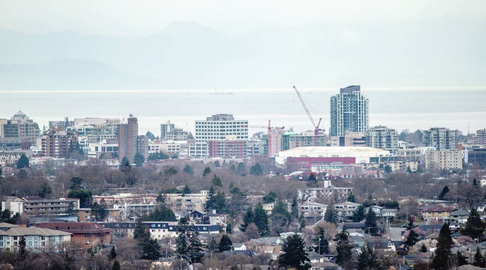
Victoria: Queen Victoria
Queen Victoria was the reigning monarch of the United Kingdom, sa���ʴ�ý and Australia and Empress of India for almost 64 years, from 1837 until her death in 1901. Known as the Mother of Confederation, she granted Royal Assent to the British North America Act, and chose Bytown (now known as Ottawa) to be the capital of sa���ʴ�ý. Many of sa���ʴ�ý’s towns, cities, geographical features, parks, buildings and streets bear her name.
The City of Victoria incorporated on Aug. 2, 1862. Victoria was the capital of Vancouver Island and later of the united colonies of Vancouver Island and British Columbia, and since the union with sa���ʴ�ý in 1871, has been the capital of British Columbia.
It was named by the officers of the Hudson’s Bay Company. In 1841, James Douglas, chief factor of the HBC, chose the area as an ideal location for a new post. Douglas spent the summer of 1842 mapping the area between Oak Bay and Esquimalt and, on March 15, 1843, selected the site for the new fort. Building started June 4, 1843, using cedar palisades cut from Mount Douglas.
Chief Trader Charles Ross, who was in charge of construction, was under the impression that the new fort was to be named in memory of the queen’s consort and named the new post Fort Albert. Supply ships put in there during the summer of 1843, and their logs variously refer to Fort Albert, Fort Victoria and Fort Camosun.
Clarification from London finally arrived, and in December 1843, with ceremony and the firing of salutes, the post was named Fort Victoria. The first British settlers arrived in the late 1840s.
Fort Victoria was demolished on Nov. 24 1864.
Celia Reefs: Unknown
The origin of this natural feature’s name is unknown and research continues. It was included on the map for its name and unique feature on the ocean floor.
Not on the map but worth noting
Port Alice
The village on northern Vancouver Island is located on Neroutsos Inlet, northwest of Port McNeill. It was originally built by Whalen Pulp and Paper Mills of Vancouver, and named after Alice Whalen, the founders’ mother.
The brothers Whalen began their construction of the mill at its present site in 1917 and the first pulp was produced in 1918. The mill at Swanson Bay farther north was also a Whalen operation.
Ladysmith
In 1904, coal baron James Dunsmuir founded a company town at Oyster Harbour for miners at his recently opened Extension colliery to the north. Dunsmuir named the new town on the 49th parallel Ladysmith, in honour of the end of the siege of Ladysmith, South Africa, during the Boer War.
Lady Smith was Spaniard Juana María de los Dolores de León Smith, a descendant of Juan Ponce de Leon. She was the wife of Major Harry Smith, a British army officer and governor of the Cape Colony in South Africa, where Ladysmith was named in her honour.


